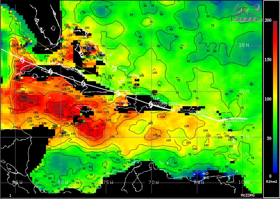
Between low shear, high ocean heat content (OHC) and very warm SSTs in a loop current in the Gulf of Mexico, Laura is likely to significantly intensify in the Gulf.
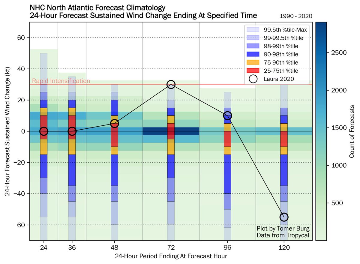
NHC is forecasting RI, which also ties the largest 24-hour intensity change forecast by NHC valid at hour 72.
NHC is forecasting RI, which also ties the largest 24-hour intensity change forecast by NHC valid at hour 72.
While it remains difficult to tell where Laura& #39;s LLC is, the system apparently continues to deviate south of the forecast track. If it remains S of Cuba & an inner core can develop, it may begin to quickly deepen even before reaching the Gulf, increasing % of a major hurricane.
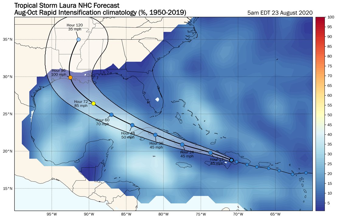
Climatology of course should not be substituted in place of dynamical reasoning, but here offers further context to NHC& #39;s RI forecast. Assuming Laura isn& #39;t significantly disrupted by terrain, it& #39;ll traverse the loop current where climatologically ~40% of TCs undergo RI.
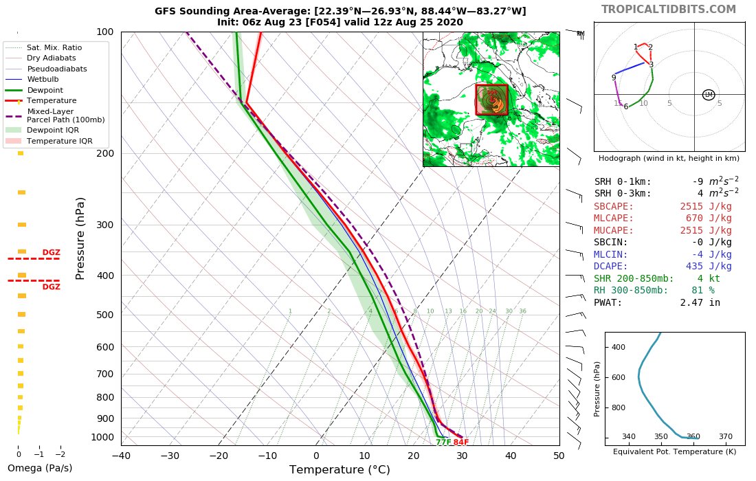
Using area-averaged soundings to try and obtain environmental shear, when Laura traverses the loop current weak deep-layer shear is expected, alongside being embedded in a fairly moist environment.
I& #39;m no alarmist, but if it can survive Cuba w/ minimal disruption... yikes.
I& #39;m no alarmist, but if it can survive Cuba w/ minimal disruption... yikes.

 Read on Twitter


